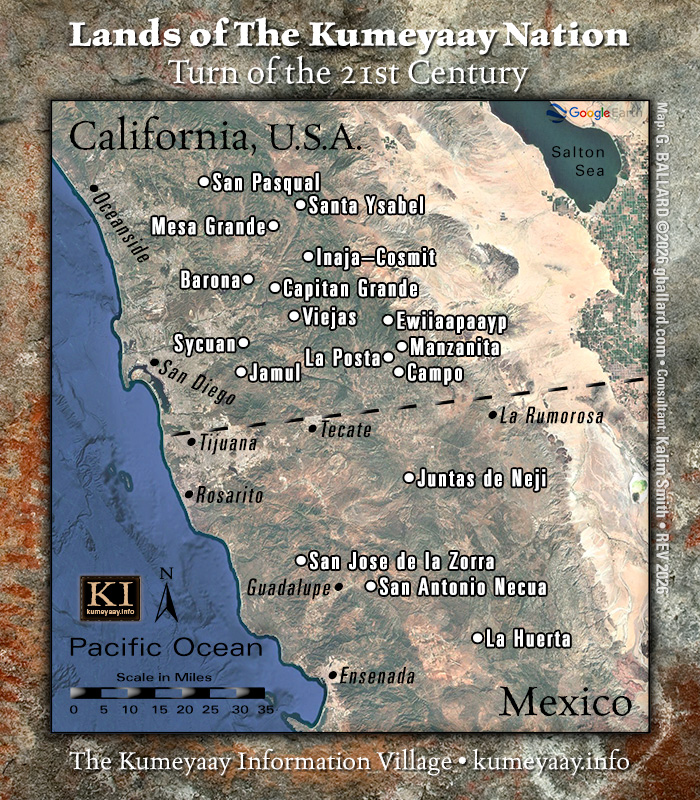
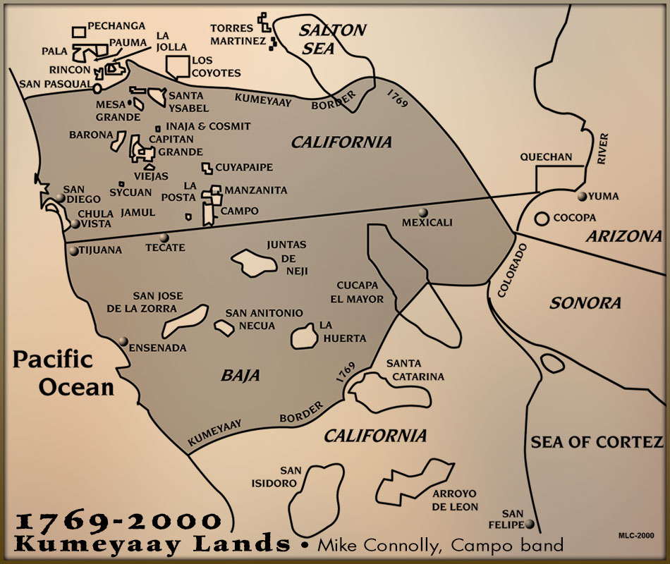
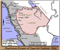
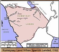
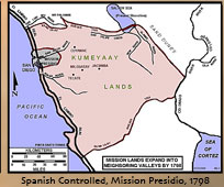
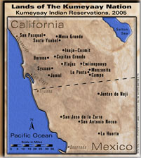
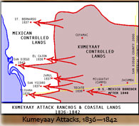
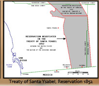
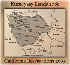
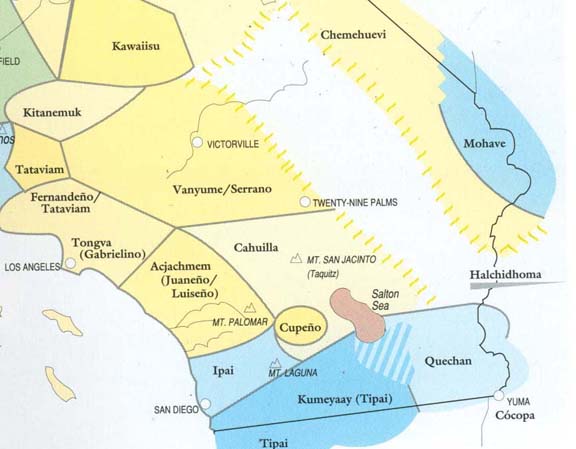
| Above current 2026 color map Lands of The Kumeyaay Nation territory at the Turn of the 21st Century compared to the historical map 1769-2000 Kumeyaay ancestral HOMELANDS located in present day U.S.-Mexico border region.
The 1769 Kumeyaay Border area (shaded in gray) shows the area tribal historians believe was controlled by the Kumeyaay Aboriginals at the time of colonial European invasion into Alta California tribal lands in the West Coast (c.1760s).
What was the Spanish Empire after in Kumeyaay country in 1760s?
GOLD!
Kosa'aay village -- GROUND ZERO for the California Tribes
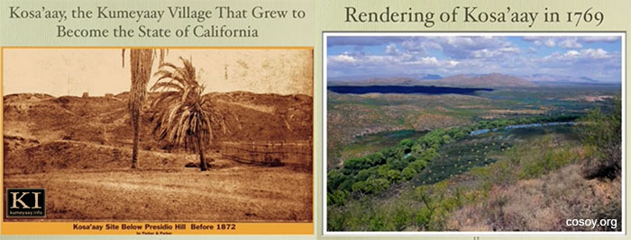
Circa 1760s, these satellite views show the precise area where the Spanish Empire's Catholic missionary priests, conquistadors and settlers entered California and got their original foothold in California tribal lands.
The area in the mid 1700s was, by historical accounts, an ancient thriving Kumeyaay village known as Kosa'aay (Cosoy).
A popular tourist destination today -- Kosa'aay is known presently as Old Town San Diego, and it exists on prime real estate located beside the San Diego River and Presidio Park. San Diego Bay and the City of San Diego are a hike south. SeaWorld and the Pacific Ocean are hikes west, both shown in the aerial photos below.
This 2026 Google Earth 3D satellite view maps the coordinates where Interstate-8 intersects with I-5 and highlights the location's surrounding historical parks, museums, restaurants, attractions.
I-8 ends at Ocean Beach just before reaching the Pacific Ocean.
Many of today's roadways were based off old Indian trails the Aboriginals used for hundreds if not thousands of years.
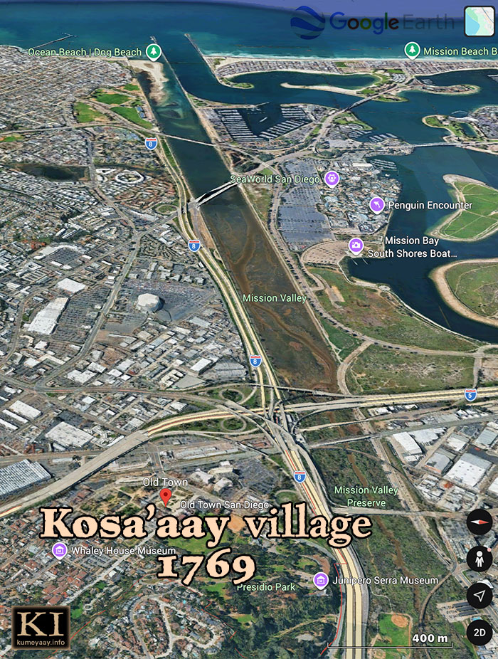
Historic present-day area of Kosa'aay pictured in 2026, now known as Old Town San Diego, a popular tourist hotspot.
The immigrants built the first river dike "Derby Dike" in the 1850s to channel the San Diego River water flow and dry out the southern marshland.
Some of the Mission Bay islands and seafloor in the top right, including Fiesta Island, were man-made, sculpted from sand dredged from San Diego Bay in the 1940s-1960s so US navy ships could transit the San Diego Bay.
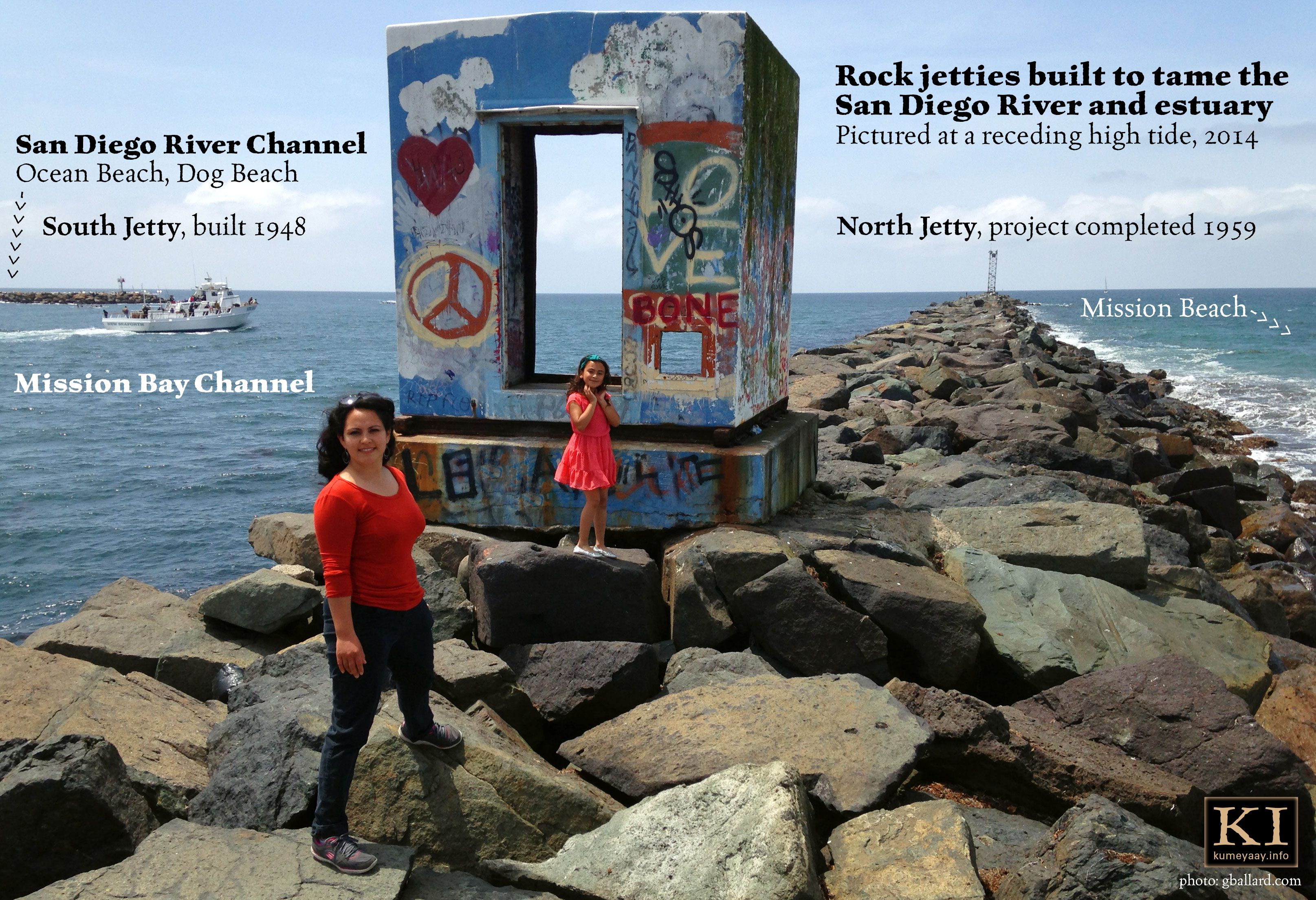
Further, when the Ocean Beach and Mission Beach jetties were built from large rocks in the 1950s -- the new Mission Bay Channel and Mission Bay were dredged to support boat traffic.
So what we see here today is a greatly human-engineered landscape topography -- not much left of the Creator's original design.
It is interesting to imagine what this area looked like in the 1700s when the Kumeyaay controlled it....
The terrain approaching I-5 would likely have been a huge spread out natural tidal marshland, floodplain and estuary that resembles the current Mission Valley river channel area (in above map).
Twice a day the ocean tides flood and drain the bay and estuary.
The tidal flows in and out of the river channel and Mission Bay are enormous... if you ever stood in the tidal current at Dog Beach or observed the water level in the bay raise or lower six feet in eight hours, you know the power of the coastal water flow.
This landscape would have been a truly magnificent ecosystem to behold in its natural state in close proximity to the City of San Diego....
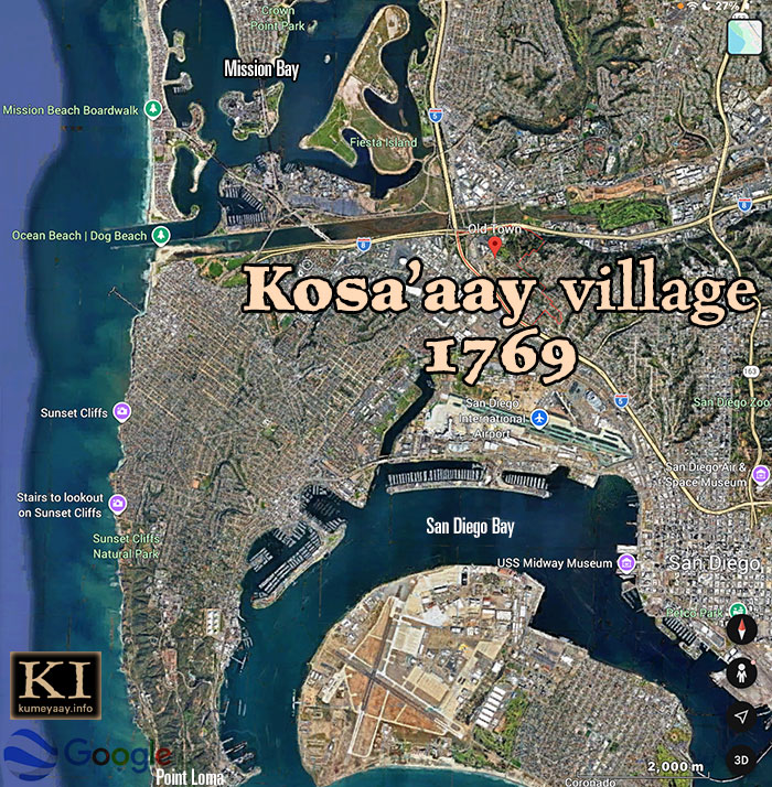
Nadir view of San Diego sea and land terrain pinpointing historic Cosoy village, and present-day tourist attractions, in and about the San Diego Bay, Mission Bay, Pacific Ocean.
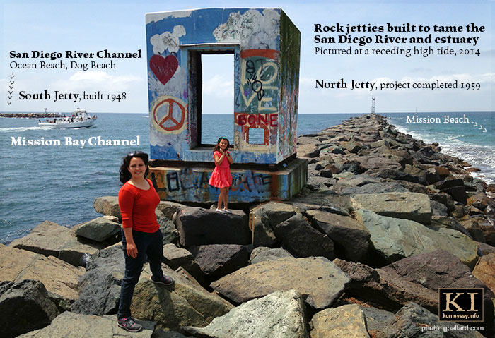
Mission Beach and Ocean Beach massive rock jetties pictured 2014, featuring the Mission Bay Channel, south jetty (started 1948) and north jetty. Project completed 1959, including dredging the channel for boat traffic.
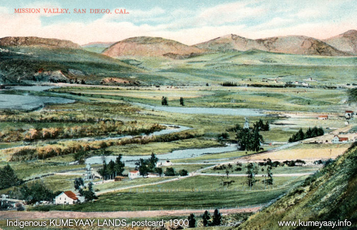
Mission Valley, c.1900 (close proximity to Kosa'aay, if not adjacent to it, maybe from Presidio hilltop) -- scene shows a natural abundance of fresh water meandering through the San Diego River before it was "tamed" by the immigrants. Interstate-8 runs along the current river. I scanned this from an original postcard, c.1900.
The Spaniard colonizers built 21 Catholic missions along the West Coast of California, and four major "presidios" (military forts) between 1769 and 1823. The Aboriginals associated with these areas became known as "Mission Indians." Some California Indian bands still include Mission Indians in their official name, but many have dropped it.
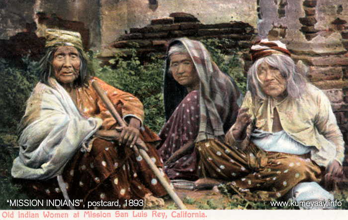
Old Mission Indian Women at Mission San Luis Rey, California, 1893. I scanned this from an original hand-colored postcard. It's a famous period scene, a favorite subject of fine-art painters. These three postcard images were likely produced from earlier black and white photographs and sold in San Diego tourist shops c.1900. Color postcards must have been a true novelty at the turn of the 20th century.
The immigrant colonial Christian missionaries, conquistadors, explorers and settlers soon spread north along the West Coast looking for the gold....
The Spanish Empire used the same model of invasion they used in 1519 to plunder the Aztec Civilization's gold -- some 250 years earlier -- during the so-called global Age of Discovery (1489-1620).
However, the real gold discovery didn't occur until some 70 years later during the California Gold Rush of 1848.
1848 was a disastrous period for the California Indigenous population, including the Mexican American War (1846-1848) that cut the US-Mexico international border through the heart of Kumeyaay territory -- effectively dividing the Kumeyaay tribe into two distinct regions.
It was estimated only 1,000 Kumeyaay Aboriginals survived the turn of the 20th century because of poor treatment by the Spanish, Mexicans, Americans....

Indian Camp, Warner Springs, c.1900, is approximately 5 miles west of Los Coyotes Indian Reservation (Cahuilla-Cupeños), and 14 miles north of Julian -- scene shows an elderly Aboriginal couple seeking refuge among the rocks under an oak-framed ramada structure -- languishing in generational abject poverty. I scanned this tourist card from a hand-painted color original, c.1900. Local museum curators will probably know the names of these people, the photographer and date it was taken.
Pushed out of sight into the high desert rocky countryside -- far away from their prime coastal lands -- most Kumeyaay survivors languished for 150-200 years....
Until the rise of legalized Indian gaming through the Indian Gaming Regulatory Act of 1988.
Tens of billions of U.S. dollars a year flowing into the Indian reservations nationwide from legal Indian casino revenue dramatically changed the future landscape for the sovereign, federally-recognized American Indian bands.
For example, the tribal gaming Kumeyaay bands have slipped the chains of abject poverty in 19th, 20th centuries and became wealthy, politically powerful, and connected business owners in the 21st century due mostly to tribal gaming revenue.
Check out our online KUMEYAAY HISTORY DEPARTMENT for an interesting research timeline brief....
Historical maps by Mike Connolly Miskwish, Kumeyaay, Campo Band of the Kumeyaay Nation. Mike writes the books on this stuff for his tribe.
Color "Lands of the Kumeyaay Nation" map was made from scratch in Adobe Photoshop by amateur cartographer Gary Ballard. Kalim Smith was the original tribal consultant on the 2001 map project. Ballard used a clean Google Earth satellite image of terrain and sea in the 2026 map revision.
EWAA KICHA -- MOVIE DVD:
Filmed in Old Town San Diego State Historic Park, 2005
PLAY MOVIE:
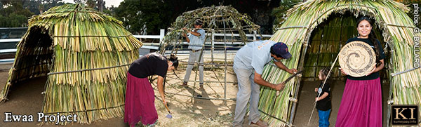
The KUMEYAAY.INFO "Ewaa" multimedia documentary is the result of a California State Parks Kumeyaay cultural project based on recreating a copy of the pre-contact Aboriginal-style houses that Spanish explorer Gaspar de Portolà reported seeing in the ancient Kumeyaay village of Kosa'aay when he first explored this ancient village region in 1769....
The project ewaa had a 14-foot diameter at its base. Its frame was built from locally-harvested willow branches, and thatched with cattail and tules from nearby marshland.
The movie stars Abel Silvas "Running Grunion" (Juaneño-Diegueño-Californio), Fausto Diaz (Kumiai), and cameos by Eva Salazar (Kumiai) and her famous Mission Indian rattlesnake juncus basket artistry that she sold in her store, Shumup Ko Hup.
The Ewaa video and stills were photographed digitally and edited to movie DVD by Gary Ballard in 2005.
"History of San Diego 1542-1907"
by WILLIAM E. SMYTHE (Introduction written in 1907)
Heavily-researched PowerPoint paper on Kosa'aay video:
Turn of the 21st century proposal, heritage tourist sites as economic resources:
DOWNLOAD PDF.
From: Geoffrey Mogilner, cosoy.org (site since deleted)
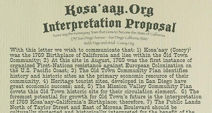
With this letter we wish to communicate that: 1) Kosa’aay (Cosoy) was the 1769 Birthplace of California and lies within the Old Town Community; 2) At this site in August, 1769 was the first instance of organized First-Nations resistance against European Colonization on the U.S. Pacific Coast; 3)....
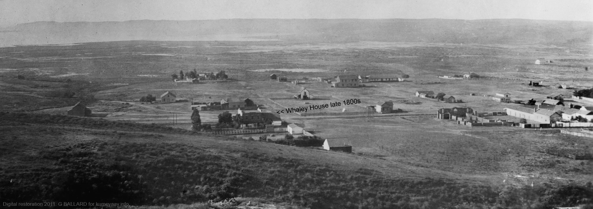
KOSA'AAY (Old Town) photographed c.1890:
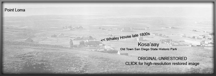
DOWNLOAD HIGH RESOLUTION RESTORED SCAN. This image looks like the original film negative was "thin" (way under exposed) and the darkroom technician printed it to match the original. I adjusted it digitally to a normal appearance in Adobe Photoshop.
If this photograph's "late 1800s" date is correct, it was filmed some 40 years after the San Diego River estuary was diked by white settlers -- around 90 years after the invaders evicted the Kumeyaay from their ancient Kosa'aay village region -- and more than 70 years since the Kumeyaay were banned from their entire prime ancestral coastal lands.
This is one of the oldest known photographs of San Diego countryside I could locate in my research.
Someone noted this view of Old Town (formerly Kosa'aay) as "looking south." It looks to me like Point Loma in the background -- which would be a southwest view from the hill. I verified this in Google Earth.
Remember the "late 1800s" when this photo was taken -- film photography was just starting out in the 1860s during the Civil War, so it was a new technology of the period.
I imprinted "Whaley House late 1800s" in the photo, known today as Old Town San Diego State Historic Park. It looks photographed from a hill, maybe Presidio Hill. I was not able to verify the exact location coordinates of Kosa'aay (Cosoy), but this picture likely shows part of it.

LIST OF CURRENT KUMEYAAY BANDS:
UNITED STATES Southern California Kumeyaay bands:
- Campo Band of the Kumeyaay Nation
- Viejas Band of Kumeyaay Indians
- Barona Band of Mission Indians
- San Pasqual Band of Indians
- Inaja Cosmit Indian Reservation
- Capitan Grande Indian Reservation
- Santa Ysabel Band of Diegueño Indians, aka Iipay Nation of Santa Ysabel
- Ewiiaapaayp Band of Kumeyaay Indians aka Cuyapaipe
- Manzanita Indian Reservation
- La Posta Indian Reservation
- Jamul Indian Village A Kumeyaay Nation
- Mesa Grande Band of Diegueño Mission Indians
- Sycuan Band of the Kumeyaay Nation
BAJA CALIFORNIA MEXICO Kumeyaay Kumiai bands:
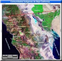
KUMEYAAY DOCUMENTARIES Indigenous peoples of California Native American series features professional photography and journalistic documentation, virtual tours of village rancherias ranchos, indigenous lifestyles of the tribal ejidos of Baja.
Los indios indígenas de las fotos documentales de la forma de vida del photojournalism de México representan películas.
2026 Map of INDIAN CASINOS in Southern California:
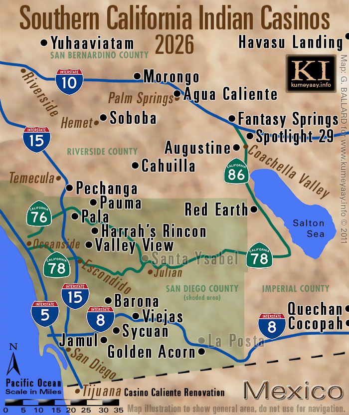
Indian casinos map pinpoints the tribal casino locations in Southern California, San Diego County -- visit our free online tribal casino guide to plan your next fun trip to the Las Vegas-style Southern California casinos, luxury resorts, golf courses... Indian Bingo was the first large social game some of the bands offered on their reservations, and it is still popular with many hundreds of visitors seated and playing the games of chance together for large cash payouts.
Card games and slot machines followed.

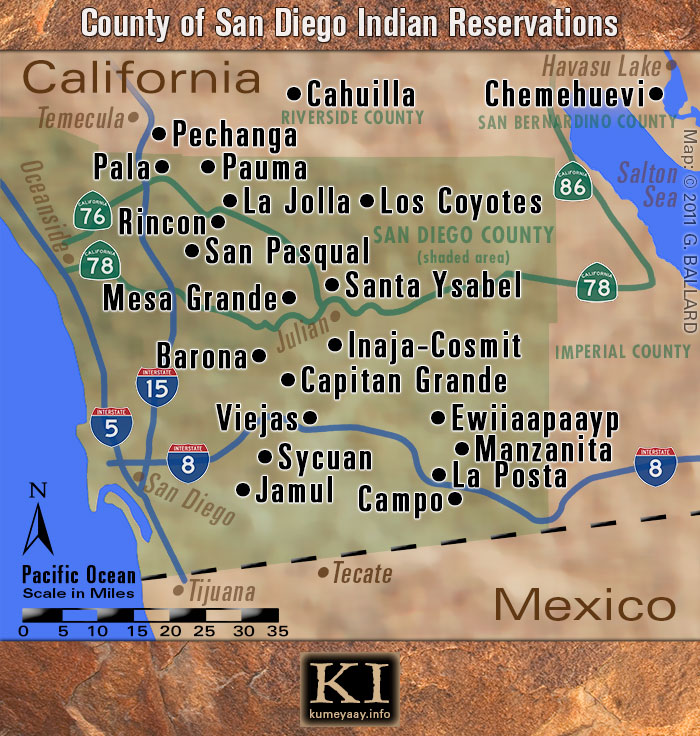
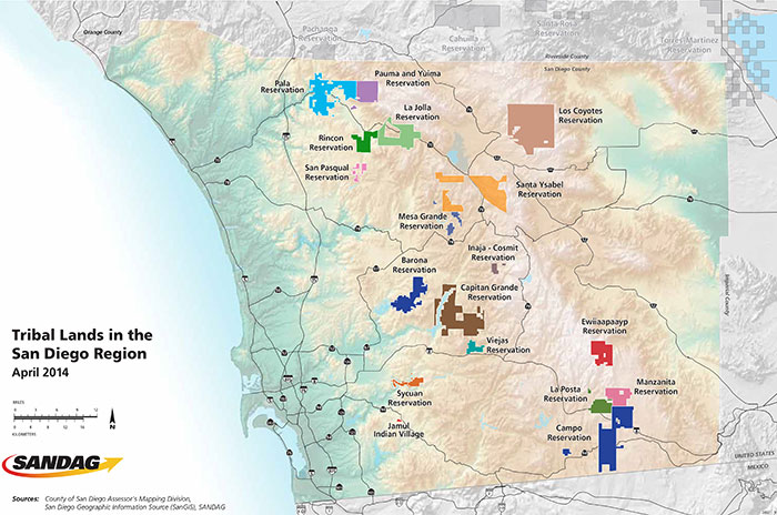
COUNTY OF SAN DIEGO TRIBAL RESERVATIONS Maps:
INDIAN COUNTRY
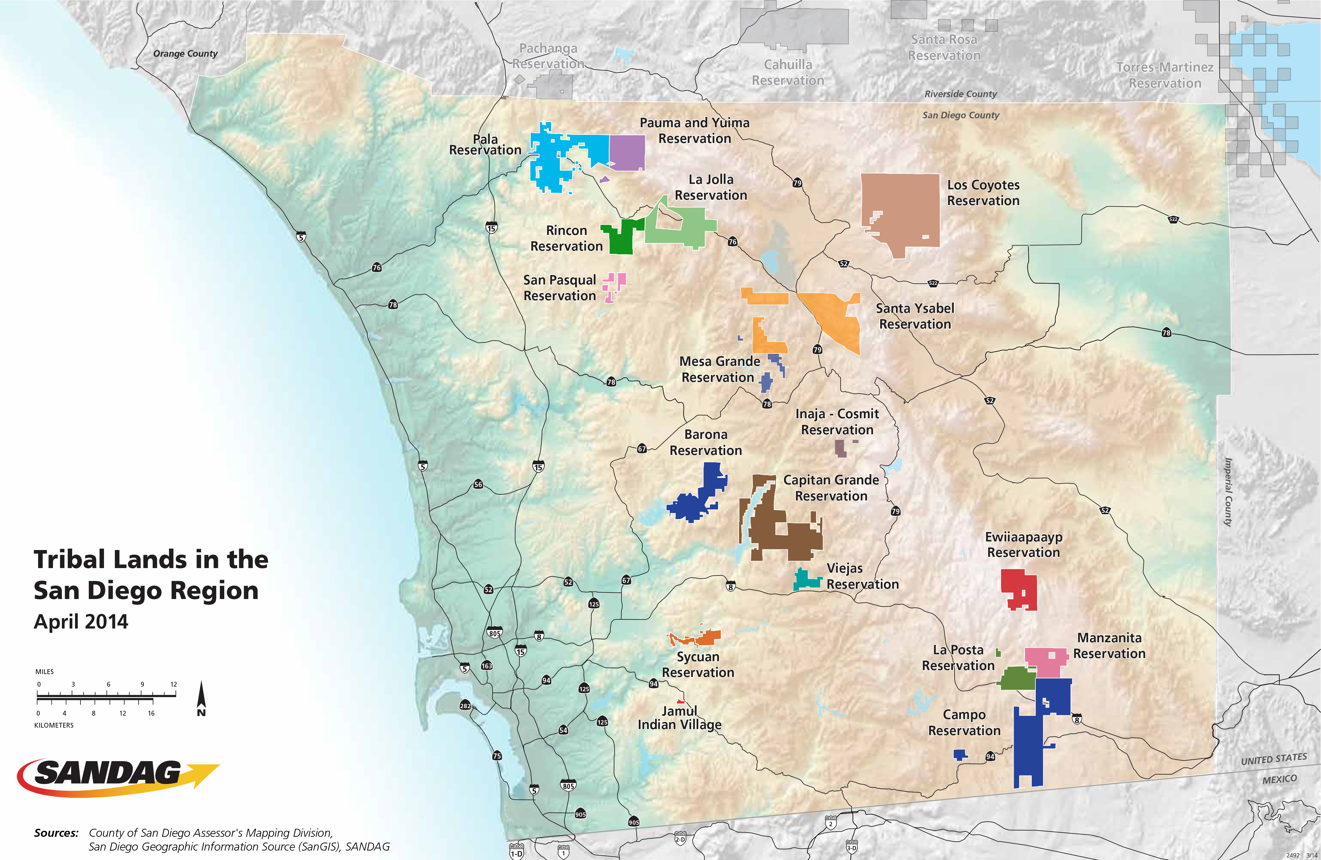
If you are in the County of San Diego -- YOU ARE IN INDIAN COUNTRY! San Diego has more American Indian reservations than any county in the United States.
The County of San Diego is contained in the green shaded area.
THIS IS HOW PROFESSIONAL CARTOGRAPHERS MAPPED THE SAN DIEGO RESERVATIONS:
DOWNLOAD

The County of San Diego Assessor's Mapping Division produced the ultimate Tribal Lands in the San Diego Region -- suitable for academic research and finely detailed enough for navigation.
WOW -- nothing like this was available when I started research on my Kumeyaay mapping project in 2001... I scanned paper maps into Photoshop and looked for the reservations which were mostly not marked, poorly documented elsewhere, and not compiled in any online lists.
Now days you just have to ask a key word and the information unfolds like a flower in great factual detail compiled by AI machine intelligence....
SOURCE | SANDAG WEBSITE (interregional collaboration)
San Diego County has 17 federally recognized tribal nations governing 18 reservations, the most of any county in the U.S.
These sovereign lands cover over 127,000 acres (about 4% of the region). The San Diego Association of Governments (SANDAG) collaborates with these nations on regional planning, infrastructure, and resource protection.
Tribal Nations and Reservations in San Diego County:
Barona Group of Capitan Grande Band (Barona Reservation)
Campo Band of Diegueño Mission Indians (Campo Reservation)
Ewiiaapaayp Band of Kumeyaay Indians (Ewiiaapaayp Reservation)
Inaja and Cosmit Band of Mission Indians (Inaja and Cosmit Reservation)
Jamul Indian Village (Jamul Reservation)
La Jolla Band of Luiseño Indians (La Jolla Reservation)
La Posta Band of Diegueño Mission Indians (La Posta Reservation)
Los Coyotes Band of Cahuilla and Cupeño Indians (Los Coyotes Reservation)
Manzanita Band of Kumeyaay Indians (Manzanita Reservation)
Mesa Grande Band of Diegueño Mission Indians (Mesa Grande Reservation)
Pala Band of Mission Indians (Pala Reservation)
Pauma Band of Luiseño Indians (Pauma & Yuima Reservation)
Rincon Band of Luiseño Indians (Rincon Reservation)
San Pasqual Band of Diegueño Mission Indians (San Pasqual Reservation)
Santa Ysabel Band of Diegueño Mission Indians (Santa Ysabel Reservation)
Sycuan Band of the Kumeyaay Nation (Sycuan Reservation)
Viejas Band of Kumeyaay Indians (Viejas Reservation) (Note: Capitan Grande is jointly held by Barona and Viejas).
HISTORICAL TRIBAL MAPS:
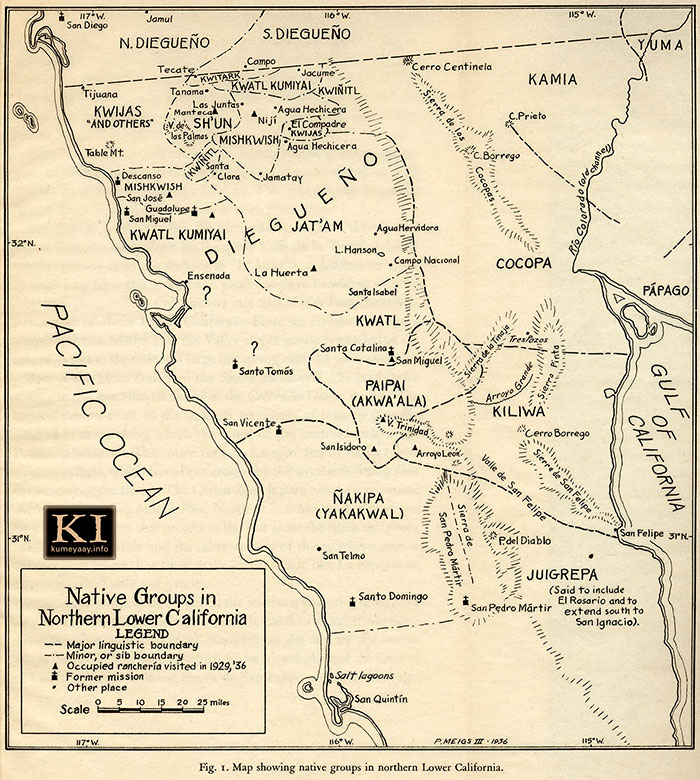
"Native Groups in Northern Lower California"
Map by PEVERIL MEIGS III 1936
HISTORICAL DIEGUENO MAP 1936 old antique map unique spellings of Mexico Diegueño Yuman tribes Mexican early 1900s, 1920s, including Jamul, San Diego, Tecate, Campo, Tijuana, Yuma, Tanama, Kwitark, Jacume, Cerro Centinela, Kamia, C. Prieto, Kwatl Kumiyai, Kwiñitl, Sierra de los Cocopas, Cocopa, C. Borrego, Rio Colorado Channel, Papago, Kwijas, Las Juntas, Niji, Agua Hechicera, El Compadre, Mishkwish, Santa Clara, Jamatay, Descanso, San Jose, Guadalupe, San Miguel, Kwatl Kumiyai, Jat'am, Agua Hervidors, Campo Nacionel, Ensenada, Santa Catalina, Sierra de la Tinaja, Sierra Pinto, Arroyo Grande, Cerro Borrego, Sierra de San Felipe, Valle de San Felipe, Sierra de San Pedro Martir, Arroyo Leon, P. del Diablo, Santo Tomos, San Vincent, San Telmo, Santa Domingo, San Pedro Martir, Juigrepa, San Quintin.
KILIWA PAI PAI MAP Early 1900s 1910s 1930s
Another high-resolution map DOWNLOAD:
HISTORICAL KILIWA PAIPAI 1920s old antique map unique spellings of Mexico Yuman Indian tribes Mexican early 1900s, 1920s, including Mesa Zone, Valle de la Trinidad Jasi(G), Cerro Colorado Kwiniel Wey, Wey Ijt, Zone of Rugged Cañons, Cuap Wey, Chipa Wey, Arroyo Carrisito, Agua Caliente, Jacopin, Jupap Wey, Jupaja, Ucha Wey, Wey Mijak, Jewiluja Wey, Jel Jumkwinep, Colwey, San isidoro Japoknian, Isicha'a, San Antonio del Valle, Nakipa, Wey Cojo, Tuwaloniwey, Jeljumkwinep, Jewiluja Wey, El Paso de San Matias, Jeji Chuwilu, San Martias Spring Jejija, San Felepe Desert, Selewalo, Kay Kesiay, Muwa Wey, Jankilawa, Kay Sipukwin, Juigrepa, Esperanza Cañyon Cuchiwa.
|